Artificial intelligence (AI) has sped up the process of detecting flooded buildings immediately after a large-scale flood, allowing emergency personnel to direct their efforts efficiently. Now, a research group from Tohoku University has created a machine learning (ML) model that uses news media photos to identify flooded buildings accurately within 24 hours of the disaster.
Their research was published in the journal Remote Sensing on April 5, 2021.
"Our model demonstrates how the rapid reporting of news media can speed up and increase the accuracy of damage mapping activities, accelerating disaster relief and response decisions, said Shunichi Koshimura of Tohoku University's International Research Institute of Disaster Science and co-author of the study.
ML and deep learning algorithms are tailored to classify objects through image analysis. For AI and ML to be effective, data is needed to train the model - flood data in the current case.
Although flood data can be collected from previous events, it will inadvertently lead to problems on account of every event being different and subject to the local characteristics of the flooded area. Thus, onsite information has higher reliability.
News crews and media teams are often the first on the scene of a disaster to broadcast images to viewers at home, and the research team recognized that this information too could be used in AI algorithms.
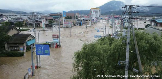
They applied their model to Mabi-cho, Kurashiki city in Okayama Prefecture, which was affected by the heavy rains across western Japan in 2018.
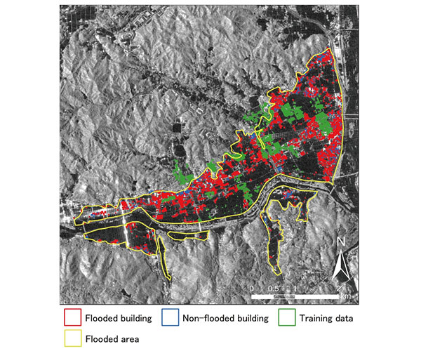
First, researchers identified press photos and geolocated them based on landmarks and other clues appearing in the photo. Next, they used synthetic aperture radar (SAR) PALSAR-2 images provided by JAXA to discretize flooded and non-flooded conditions of unknown areas.
Here, SAR images can be employed to classify water bodies since microwaves irradiate differently on wet and dry surfaces. A support vector machine (SVM), one of the machine learning techniques, was used to classify buildings surrounded by floodwaters or within non-flooded areas.
"The performance of our model resulted in an 80% estimation accuracy," added Koshimura.
Looking ahead, the research group will explore the applicability of news media databases from past events as training datasets for developing AI Models at present situations to increase the accuracy and speed of classification.
- Publication Details:
Title: The Potential Role of News Media to Construct a Machine Learning Based Damage Mapping Framework
Authors: Genki Okada, Luis Moya, Erick Mas, Shunichi Koshimura
Journal: Remote Sensing
DOI: 10.3390/rs13071401
Contact:
Shunichi Koshimura
International Research Institute of Disaster Science
Email: koshimura irides.tohoku.ac.jp